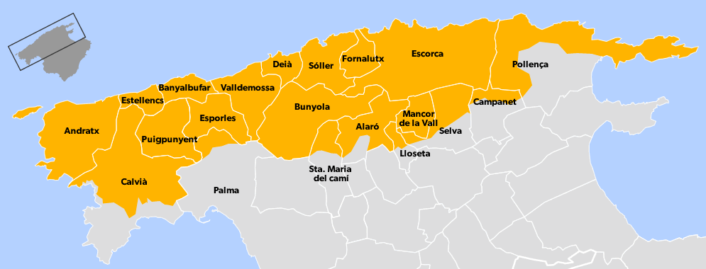
UNESCO and SOLLER

UNESCO AND SOLLER

Soller is at the centre of the UNESCO designated range of mountains. This interesting map and information are taken from thewww.serradetramunata.net website for your information.

The Serra de Tramuntana mountain range forms the backbone of the north-west of Mallorca. It runs for around 90 km, with a maximum width of 15 km, over 18 municipalities, the largest of which are Calvià, Pollença and Escorca—, and covers 30% of the island’s territory and more than 1,000 km2. Approximately 8,000 people live in the central areas, but the buffer zone population is 40,000 inhabitants. Several of its peaks have an altitude of over 1000 m, and the highest are Puig Major (1,443 m), Puig de Massanella (1,348 m), Serra d’Alfàbia (1,069 m), Es Teix (1,064) and Galatzó (1,026 m).

Leave a Reply